ខេត្តឡាយចឺវ
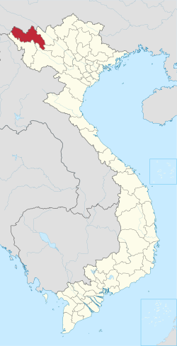
ខេត្តឡាយចឺវ គឺជាខេត្តមួយនៅតំបន់ភាគពាយ័ព្យនៃប្រទេសវៀតណាម ។ ខេត្តឡាយចឺវ ជាតំបន់មួយក្នុងចំណោមតំបន់ដែលមានប្រជាជនតិចបំផុតក្នុងប្រទេសវៀតណាម ហើយវាមានព្រំប្រទល់ជាប់នឹងប្រទេសចិន។ វាធ្លាប់ជាសហព័ន្ឋតៃ ពាក់កណ្តាលឯករាជ្យដែលគេស្គាល់ថាជាស៊ីបសុងចូវតៃ ប៉ុន្តែត្រូវបានបារាំងស្រូបចូលទៅក្នុងឥណ្ឌូចិនរបស់បារាំងក្នុងទសវត្សរ៍ឆ្នាំ១៨៨០ ហើយក្រោយមកបានក្លាយជាផ្នែកមួយនៃប្រទេសវៀតណាមបន្ទាប់ពីឯករាជ្យរបស់វៀតណាមនៅឆ្នាំ១៩៥៤។ [៤] [៥] វាបានក្លាយជាផ្នែកមួយនៃតំបន់ស្វយ័តភាគពាយ័ព្យនៃ សាធារណរដ្ឋប្រជាធិបតេយ្យវៀតណាមពីឆ្នាំ១៩៥៥ ដល់ឆ្នាំ១៩៧៥ នៅពេលដែលខេត្តឡាយចឺវ ត្រូវបានបង្កើតឡើង។ ខេត្តឌៀនបៀន ត្រូវបានឆ្លាក់ចេញពីឡាយចឺវ ក្នុងឆ្នាំ២០០៤។ ខេត្តនេះមានផ្ទៃដី ៩០៦៨.៧៩ គីឡូម៉ែត្រការ៉េ ហើយគិតត្រឹមឆ្នាំ២០១៩ វាមានប្រជាជនចំនួន ៤៦០ ១៩៦ នាក់។
| Lai Châu province Tỉnh Lai Châu | |
|---|---|
| Province | |
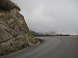
| [[File:|250px|none|alt=|Lai Châu City Lake • Lai Châu Mountain • Town square in Lai Châu • Hoàng Liên Sơn Mountain • Ô Quy Hồ Mountain pass • Suspension bridge Lai Châu • Than Uyên Mountain]]Lai Châu City Lake • Lai Châu Mountain • Town square in Lai Châu • Hoàng Liên Sơn Mountain • Ô Quy Hồ Mountain pass • Suspension bridge Lai Châu • Than Uyên Mountain | |
 | |
[[File: |250px|none|alt=|Location of Lai Châu province]] |250px|none|alt=|Location of Lai Châu province]] | |
| Country | |
| Region | Northwest |
| Capital | Lai Châu |
| Subdivision | 1 city, 7 rural districts |
| រដ្ឋាភិបាល | |
| • ប្រភេទ | Province |
| • Body | Lai Châu Provincial People's Council |
| • Chairman of People's Council | Giàng Páo Mỷ |
| ផ្ទៃក្រឡា[១][២] | |
| • Province | ៩០៦៨.៨ គម2 (៣៥០១.៥ ម៉ាយ ការ) |
| ប្រជាជន (2021)[៣] | |
| • Province | ៤៧៣,៥១៩ |
| • សន្ទភាព | ០.០៥២/km2 (០.១៤/sq mi) |
| • Urban | ៩០,៧០២ |
| Ethnic groups[៣] | |
| • Thái | 31.05% |
| Area codes | 213 |
| ក្រមអ.ម.អ. ៣១៦៦ | VN-01 |
| គេហទំព័រ | laichau.gov.vn |
ឯកសារយោង
កែប្រែ- ↑ "Phê duyệt và công bố kết quả thống kê diện tích đất đai của cả nước năm 2018" (ជាVietnamese). Act No. 2908/QĐ-BTNMT of Error: the
dateoryearparameters are either empty or in an invalid format, please use a valid year foryear, and use DMY, MDY, MY, or Y date formats fordate. Ministry of Natural Resources and Environment (Vietnam). http://www.monre.gov.vn/VanBan/Lists/VanBanChiDao/Attachments/2299/QD%202908.rar. - the data in the report are in hectares, rounded to integers - ↑ "STATISTICAL YEARBOOK 2019". General Statistics Office of Vietnam. 2020-06-30.
- ↑ ៣,០ ៣,១ General Statistics Office of Vietnam (2019). "Completed Results of the 2019 Viet Nam Population and Housing Census". Statistical Publishing House (Vietnam). ល.ស.ប.អ. 978-604-75-1532-5. https://www.gso.gov.vn/wp-content/uploads/2019/12/Ket-qua-toan-bo-Tong-dieu-tra-dan-so-va-nha-o-2019.pdf.
- ↑ Forbes, Andrew, and Henley, David: Vietnam Past and Present: The North (History and culture of Hanoi and Tonkin).
- ↑ "WHKMLA : Historical Atlas, Laos Page".


