Bohaiseamap2.png(៥៦៩ × ៤៨៧ ភីកសែល ទំហំឯកសារ៖ ១៣៦គីឡូបៃ ប្រភេទ MIME៖ image/png)

ឯកសារ​នេះ​មាន​ប្រភព​មក​ពី Wikimedia Commons និង​អាច​ត្រូវ​បាន​ប្រើ​ដោយ​គម្រោង​ដទៃ​ទៀត។ ការ​ពណ៌នា​នៅ​លើទំព័រពណ៌នាអំពី​វា មាន​បង្ហាញ​ខាង​ក្រោម​នេះ។

Warning sign This file requires updating because: I suggest using the more normative 'Pyongyang' and 'Yellow River' or at least adding these forms in parentheses. In doing so, you could add a timestamp to the file.
Please notify the uploader with {{subst:update-note|1=File:Bohaiseamap2.png|2=I suggest using the more normative 'Pyongyang' and 'Yellow River' or at least adding these forms in parentheses.}} ~~~~

ចំណារពន្យល់

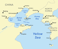
ការ​ពិពណ៌នា Map of the Bohai Sea and surrounding bays. For a more general map of the same area see Image:Bohai Sea map.png
កាលបរិច្ឆេទ
ប្រភព self-made, based on DCW data.
អ្នក​និពន្ធ Kmusser
ទំរង់​ផ្សេង​ទៀត

Derivative works of this file:

រូបភាព​​ map​​​នេះ​ គួរ​តែ​បង្កើត​ឡើង​វិញដោយប្រើក្រាភិក​វ៉ិចទ័រ ដែលជា​ប្រភេទហ្វាល់ SVG ការ​បង្កើត​រូបភាព​ជា​ហ្វាល់ SVG ផ្តល់​នូវ​អត្ថ​ប្រយោជ​ន៍​ជាច្រើន​។ ចំពោះព័ត៌មាន​បន្ថែម សូមមើល Commons:Media for cleanup ។ ប្រសិន​បើ​ទំរង់ SVG នៃ​រូបភាព​នេះ​ត្រូវ​បាន​បង្កើត​រួចរាល់ហើយ សូមអាប់ឡូដ​វា។ បន្ទាប់ពី​អាប់ឡូដ​ជា​ទំរង់ SVG សូម​ជំនួស​ទំព័រគំរូ​នេះ​ដោយ {{vector version available|ឈ្មោះ​រូបភាព​ថ្មី.svg}}

ការដាក់​អាជ្ញាប័ណ្ណ

I, the copyright holder of this work, hereby publish it under the following license:
w:en:Creative Commons
ភាពជាម្ចាស់កម្មសិទ្ធ share alike
ឯកសារនេះជាប់អាជ្ញាបណ្ឌCreative Commons Attribution-Share Alike 2.5 Generic
អ្នកមានសិទ្ធិ៖
  • ចែកចាយ – ថតចំលងនិងចែកចាយស្នាដៃនេះ
  • កែច្នៃ – កែច្នៃយកទៅប្រើ
ក្រោមលក្ខខណ្ឌដូចតទៅនេះ៖
  • ភាពជាម្ចាស់កម្មសិទ្ធ – You must give appropriate credit, provide a link to the license, and indicate if changes were made. You may do so in any reasonable manner, but not in any way that suggests the licensor endorses you or your use.
  • share alike – If you remix, transform, or build upon the material, you must distribute your contributions under the same or compatible license as the original.

Captions

Add a one-line explanation of what this file represents
Map of the Bohai Sea and surrounding bays

Items portrayed in this file

depicts អង់គ្លេស

creator អង់គ្លេស

some value

author name string អង់គ្លេស: Kmusser
Wikimedia username អង់គ្លេស: Kmusser

copyright status អង់គ្លេស

copyrighted អង់គ្លេស

copyright license អង់គ្លេស

inception អង់គ្លេស

២៧ ខែមិថុនា 2007

MIME type អង់គ្លេស

image/png

checksum អង់គ្លេស

e776fb894d1db142a63c8f0d600c8d6c18de759c

determination method អង់គ្លេស: SHA-1 អង់គ្លេស

data size អង់គ្លេស

១៣៩១០០ byte

height អង់គ្លេស

៤៨៧ pixel

width អង់គ្លេស

៥៦៩ pixel

ប្រវត្តិ​ឯកសារ

ចុចលើម៉ោងនិងកាលបរិច្ឆេទដើម្បីមើលឯកសារដែលបានផ្ទុកឡើងនៅពេលនោះ។

ម៉ោងនិងកាលបរិច្ឆេទកូនរូបភាពវិមាត្រអ្នកប្រើប្រាស់យោបល់
បច្ចុប្បន្នម៉ោង១៩:៣៣ ថ្ងៃព្រហស្បតិ៍ ទី០៧ ខែមករា ឆ្នាំ២០២១កូន​រូប​ភាព​​សម្រាប់​កំណែ​ (version) កាល​ពី​​ ម៉ោង១៩:៣៣ ថ្ងៃព្រហស្បតិ៍ ទី០៧ ខែមករា ឆ្នាំ២០២១៥៦៩ × ៤៨៧ (១៣៦គីឡូបៃ)Ras67black frame cropped and alpha channel removed
ម៉ោង១៤:៥៩ ថ្ងៃពុធ ទី២៧ ខែមិថុនា ឆ្នាំ២០០៧កូន​រូប​ភាព​​សម្រាប់​កំណែ​ (version) កាល​ពី​​ ម៉ោង១៤:៥៩ ថ្ងៃពុធ ទី២៧ ខែមិថុនា ឆ្នាំ២០០៧៥៨៣ × ៥០០ (១៧៩គីឡូបៃ)Kmusseradded strait
ម៉ោង១៤:៥០ ថ្ងៃពុធ ទី២៧ ខែមិថុនា ឆ្នាំ២០០៧កូន​រូប​ភាព​​សម្រាប់​កំណែ​ (version) កាល​ពី​​ ម៉ោង១៤:៥០ ថ្ងៃពុធ ទី២៧ ខែមិថុនា ឆ្នាំ២០០៧៥០០ × ៤២៩ (១៤១គីឡូបៃ)Kmusser{{Information |Description=Map of the Bohai Sea and surrounding bays. For a more general map of the same area see Image:Bohai Sea map.png |Source=self-made, based on DCW data. |Date=June 27, 2007

2 ទំព័រ ខាងក្រោម​ប្រើប្រាស់​ឯកសារនេះ ៖

បម្រើបម្រាស់ឯកសារជាសាកល

វីគីដទៃទៀតដូចខាងក្រោមនេះប្រើប្រាស់ឯកសារនេះ៖

View more global usage of this file.

ទិន្នន័យ​មេតា