ឯកសារ:Boten–Vientiane railway crossing Vientiane–Boten Expressway - Mapillary (vwog4i1S3AEbshtZp5Gi49).jpg

ទំហំរបស់ការមើលមុននេះ: ៨០០ × ៤៣៤ ភីកសែ។ ភាពម៉ត់ផ្សេងទៀត៖ ៣២០ × ១៧៣ ភីកសែ | ៦៤០ × ៣៤៧ ភីកសែ | ១០២៤ × ៥៥៥ ភីកសែ | ១៦២០ × ៨៧៨ ភីកសែ។
រូបភាពដើម (១៦២០ × ៨៧៨ ភីកសែល ទំហំឯកសារ៖ ១៧៤គីឡូបៃ ប្រភេទ MIME៖ image/jpeg)
.jpg)
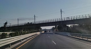
| ការពិពណ៌នា | Boten–Vientiane railway crossing Vientiane–Boten Expressway | ||
| កាលបរិច្ឆេទ | 09:25:09.359Z | ||
| ប្រភព |
|
||
| អ្នកនិពន្ធ | _khamla_phimmasone_US$ @ Mapillary.com | ||
| ការអនុញ្ញាត (ប្រើឯកសារនេះឡើងវិញ) |
This file is licensed under the Creative Commons Attribution-Share Alike 4.0 International license.
|
| ទីតាំងម៉ាស៊ីនថត | | រូបភាពនេះនិងរូបភាពផ្សេងទៀតនៅឯទីតាំងរបស់វាលើ: OpenStreetMap |
|---|
.jpg¶ms=018.228005_N_0102.482279_E_globe:Earth_type:camera_heading:203.95&language=km)
ប្រវត្តិឯកសារ
ចុចលើម៉ោងនិងកាលបរិច្ឆេទដើម្បីមើលឯកសារដែលបានផ្ទុកឡើងនៅពេលនោះ។
| ម៉ោងនិងកាលបរិច្ឆេទ | កូនរូបភាព | វិមាត្រ | អ្នកប្រើប្រាស់ | យោបល់ | |
|---|---|---|---|---|---|
| បច្ចុប្បន្ន | ម៉ោង១៤:៤១ ថ្ងៃអង្គារ ទី០៤ ខែឧសភា ឆ្នាំ២០២១ | | ១៦២០ × ៨៧៨ (១៧៤គីឡូបៃ) | Pieceofmetalwork | crop, reduced reflection |
| ម៉ោង១៩:៤២ ថ្ងៃអាទិត្យ ទី០២ ខែឧសភា ឆ្នាំ២០២១ |  | ២០៤៨ × ៩៦៧ (២០២គីឡូបៃ) | Pieceofmetalwork | Transferred from https://d1cuyjsrcm0gby.cloudfront.net/vwog4i1S3AEbshtZp5Gi49/thumb-2048.jpg |
បម្រើបម្រាស់ឯកសារ
ទំព័រ ខាងក្រោមប្រើប្រាស់ឯកសារនេះ ៖
បម្រើបម្រាស់ឯកសារជាសាកល
វីគីដទៃទៀតដូចខាងក្រោមនេះប្រើប្រាស់ឯកសារនេះ៖
- ការប្រើប្រាស់នៅក្នុង de.wikipedia.org
- ការប្រើប្រាស់នៅក្នុង en.wikipedia.org
- ការប្រើប្រាស់នៅក្នុង ja.wikipedia.org
- ការប្រើប្រាស់នៅក្នុង lo.wikipedia.org
- ការប្រើប្រាស់នៅក្នុង th.wikipedia.org
.jpg)