ឯកសារ:China edcp location map.svg

Size of this PNG preview of this SVG file: ៥១២ × ៤០៨ ភីកសែ. ភាពម៉ត់ផ្សេងទៀត៖ ៣០១ × ២៤០ ភីកសែ | ៦០២ × ៤៨០ ភីកសែ | ៩៦៤ × ៧៦៨ ភីកសែ | ១២៨០ × ១០២០ ភីកសែ | ២៥៦០ × ២០៤០ ភីកសែ។
រូបភាពដើម (ឯកសារប្រភេទSVG ៥១២ × ៤០៨ ភីកសែល ទំហំឯកសារ៖ ២.៥៦មេកាបៃ)
ចំណារពន្យល់
| ការពិពណ៌នា |
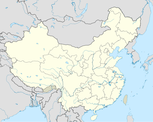
English: Location map of China.
EquiDistantConicProjection : Central parallel :
Central meridian :
Standard parallels:
Latitudes on the central meridian :
|
| កាលបរិច្ឆេទ | |
| ប្រភព | ការងារផ្ទាល់របស់អ្នកផ្ទុកឡើង |
| អ្នកនិពន្ធ | Uwe Dedering |
| ទំរង់ផ្សេងទៀត |
Derivative works of this file:
|
| SVG genesis | រូបភាពក្រាភិកវ៉ិចទ័រនេះត្រូវបានបង្កើតឡើងដោយប្រើ Adobe Illustrator, and with Inkscape. |

ការដាក់អាជ្ញាប័ណ្ណ
I, the copyright holder of this work, hereby publish it under the following licenses:
ឯកសារនេះជាប់អាជ្ញាបណ្ឌCreative Commons Attribution-Share Alike 3.0 Unported។
- អ្នកមានសិទ្ធិ៖
- ចែកចាយ – ថតចំលងនិងចែកចាយស្នាដៃនេះ
- កែច្នៃ – កែច្នៃយកទៅប្រើ
- ក្រោមលក្ខខណ្ឌដូចតទៅនេះ៖
- ភាពជាម្ចាស់កម្មសិទ្ធ – You must give appropriate credit, provide a link to the license, and indicate if changes were made. You may do so in any reasonable manner, but not in any way that suggests the licensor endorses you or your use.
- share alike – If you remix, transform, or build upon the material, you must distribute your contributions under the same or compatible license as the original.

|
រូបភាពនៃទំព័រនេះជាកម្មសិទ្ធិរបស់GNU Free Documentation License។ Version 1.2 ឬក៏ខ្ពស់ជាងនេះត្រូវបានឧបត្ថមគាំទ្រដោយ មូលនិធិសូហ្វវែរដោយឥតគិតថ្លៃ (Free Software Foundation) ដែលមិនមានផ្នែកណាមួយរបស់ប្រភពដើមរួមទាំងអក្សរនៅលើគំរបមុខនិងខ្នង ត្រូវបានផ្លាស់ប្តូរទេ។ ចំពោះផ្នែកដែលមិនអាចផ្លាស់ប្តូរបាន សូមមើលGNU Free Documentation License។ |
You may select the license of your choice.
ប្រវត្តិឯកសារ
ចុចលើម៉ោងនិងកាលបរិច្ឆេទដើម្បីមើលឯកសារដែលបានផ្ទុកឡើងនៅពេលនោះ។
| ម៉ោងនិងកាលបរិច្ឆេទ | កូនរូបភាព | វិមាត្រ | អ្នកប្រើប្រាស់ | យោបល់ | |
|---|---|---|---|---|---|
| បច្ចុប្បន្ន | ម៉ោង០៤:១០ ថ្ងៃច័ន្ទ ទី១៣ ខែធ្នូ ឆ្នាំ២០២១ | | ៥១២ × ៤០៨ (២.៥៦មេកាបៃ) | Maanshen | Update borders and land reclamation. |
| ម៉ោង០២:៤៤ ថ្ងៃអាទិត្យ ទី៣១ ខែតុលា ឆ្នាំ២០២១ |  | ៥១២ × ៤០៨ (២.៥៤មេកាបៃ) | Not logging in | Fix colored path shown as land in XInjiang and Gansu. | |
| ម៉ោង០២:៤១ ថ្ងៃអាទិត្យ ទី៣១ ខែតុលា ឆ្នាំ២០២១ |  | ៥១២ × ៤០៨ (២.៥៤មេកាបៃ) | Not logging in | FIx | |
| ម៉ោង០២:៣៥ ថ្ងៃអាទិត្យ ទី៣១ ខែតុលា ឆ្នាំ២០២១ |  | ៥១២ × ៤០៨ (២.៥៤មេកាបៃ) | Not logging in | Corrected borders for Xinjiang, Qinghai, and Gansu provincial borders per request, see NordNordWest's talk page | |
| ម៉ោង១២:៣២ ថ្ងៃច័ន្ទ ទី២៩ ខែមីនា ឆ្នាំ២០២១ |  | ៥១២ × ៤០៨ (២.៣៦មេកាបៃ) | 瑞丽江的河水 | Reverted to version as of 09:13, 22 February 2021 (UTC), disputed area, special color | |
| ម៉ោង០៧:៤០ ថ្ងៃច័ន្ទ ទី២៩ ខែមីនា ឆ្នាំ២០២១ |  | ១១៨១ × ៩៤០ (៤.០៧មេកាបៃ) | Turbo Slayer 2021 | Reverted to version as of 02:23, 28 March 2021 (UTC)Firstly, Taiwan is not a part of China cause the Government of Taiwan is Republic of China. Southern Tibet is a part of India not China. That's all | |
| ម៉ោង១៤:០៨ ថ្ងៃអាទិត្យ ទី២៨ ខែមីនា ឆ្នាំ២០២១ |  | ៥១២ × ៤០៨ (២.៣៦មេកាបៃ) | 瑞丽江的河水 | Reverted to version as of 09:13, 22 February 2021 (UTC) | |
| ម៉ោង០២:២៣ ថ្ងៃអាទិត្យ ទី២៨ ខែមីនា ឆ្នាំ២០២១ |  | ១១៨១ × ៩៤០ (៤.០៧មេកាបៃ) | Turbo Slayer 2021 | Reverted to version as of 20:14, 31 August 2011 (UTC) | |
| ម៉ោង០៩:១៣ ថ្ងៃច័ន្ទ ទី២២ ខែកុម្ភៈ ឆ្នាំ២០២១ |  | ៥១២ × ៤០៨ (២.៣៦មេកាបៃ) | DokiDonkey | Fix | |
| ម៉ោង០៩:២៣ ថ្ងៃសុក្រ ទី១៩ ខែកុម្ភៈ ឆ្នាំ២០២១ |  | ៥១២ × ៤០៨ (២.៣៤មេកាបៃ) | DokiDonkey | Change Trans-Karakoram Tract |
បម្រើបម្រាស់ឯកសារ
2 ទំព័រ ខាងក្រោមប្រើប្រាស់ឯកសារនេះ ៖
បម្រើបម្រាស់ឯកសារជាសាកល
វីគីដទៃទៀតដូចខាងក្រោមនេះប្រើប្រាស់ឯកសារនេះ៖
- ការប្រើប្រាស់នៅក្នុង ace.wikipedia.org
- ការប្រើប្រាស់នៅក្នុង af.wikipedia.org
- Nanjing
- Groot Muur van China
- Sjabloon:Liggingkaart Volksrepubliek China
- Shangqiu
- Dongguan
- Wenzhou
- Zibo
- Suzhou, Jiangsu
- Kaifeng
- Qingdao
- Xiamen
- Shantou
- Wuxi
- Quanzhou
- Shijiazhuang
- Changsha
- Hefei
- Kunming
- Tangshan
- Ningbo
- Fuzhou
- Changzhou
- Taizhou, Zhejiang
- Ürümqi
- Guiyang
- Xuzhou
- Nanchang
- Lanzhou
- Anshan
- Yangzhou
- Nantong
- Hohhot
- Jilin (stad)
- Huainan
- Linyi
- Xiangtan
- Huizhou
- Baotou
- Nanyang
- Baoding
- Liuzhou
- Tai'an
- Fuyang
- Jiangmen
- Yinchuan
- Weifang
- Zhuhai
- Huangshi
View more global usage of this file.