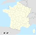
ឯកសារ:France location map-Regions and departements 1975-2014.svg

Size of this PNG preview of this SVG file: ៦២៤ × ៦០០ ភីកសែ. ភាពម៉ត់ផ្សេងទៀត៖ ២៥០ × ២៤០ ភីកសែ | ៤៩៩ × ៤៨០ ភីកសែ | ៧៩៩ × ៧៦៨ ភីកសែ | ១០៦៦ × ១០២៤ ភីកសែ | ២១៣១ × ២០៤៨ ភីកសែ | ២០០០ × ១៩២២ ភីកសែ។
រូបភាពដើម (ឯកសារប្រភេទSVG ២០០០ × ១៩២២ ភីកសែល ទំហំឯកសារ៖ ៧៥៣គីឡូបៃ)
ប្រវត្តិឯកសារ
ចុចលើម៉ោងនិងកាលបរិច្ឆេទដើម្បីមើលឯកសារដែលបានផ្ទុកឡើងនៅពេលនោះ។
| ម៉ោងនិងកាលបរិច្ឆេទ | កូនរូបភាព | វិមាត្រ | អ្នកប្រើប្រាស់ | យោបល់ | |
|---|---|---|---|---|---|
| បច្ចុប្បន្ន | ម៉ោង១៤:០០ ថ្ងៃព្រហស្បតិ៍ ទី១៩ ខែតុលា ឆ្នាំ២០១៧ |  | ២០០០ × ១៩២២ (៧៥៣គីឡូបៃ) | Sting | No borders over the Lake of Constance |
| ម៉ោង១២:៣២ ថ្ងៃអង្គារ ទី០២ ខែតុលា ឆ្នាំ២០១២ |  | ២០០០ × ១៩២២ (៧៥៤គីឡូបៃ) | Palosirkka | Reverted to version as of 16:12, 2 February 2009 Location maps must remain very accurate | |
| ម៉ោង០៨:៥៦ ថ្ងៃអង្គារ ទី០២ ខែតុលា ឆ្នាំ២០១២ |  | ២០០០ × ១៩២២ (៣០៤គីឡូបៃ) | Palosirkka | Scrubbed with http://codedread.com/scour/ | |
| ម៉ោង១៦:១២ ថ្ងៃច័ន្ទ ទី០២ ខែកុម្ភៈ ឆ្នាំ២០០៩ |  | ២០០០ × ១៩២២ (៧៥៤គីឡូបៃ) | Yug | Restore light style version ; a specific file name will be use for polygon departement maps. | |
| ម៉ោង១៩:៣៤ ថ្ងៃអាទិត្យ ទី០១ ខែកុម្ភៈ ឆ្នាំ២០០៩ |  | ២០០០ × ១៩២២ (១.៧៦មេកាបៃ) | Yug | restore East and southern border deleted by mistake + code improving. | |
| ម៉ោង១៤:៤១ ថ្ងៃអាទិត្យ ទី០១ ខែកុម្ភៈ ឆ្នាំ២០០៩ |  | ២០០០ × ១៩២២ (១.៧៧មេកាបៃ) | Yug | Statistic friendly added, as an upper layer. | |
| ម៉ោង១៣:២៣ ថ្ងៃសុក្រ ទី០៧ ខែវិច្ឆិកា ឆ្នាំ២០០៨ |  | ២០០០ × ១៩២២ (៧៥៤គីឡូបៃ) | Sting | + boundary for Channel Islands | |
| ម៉ោង១៦:២៩ ថ្ងៃសៅរ៍ ទី២៣ ខែសីហា ឆ្នាំ២០០៨ |  | ២០០០ × ១៩២២ (៧៥២គីឡូបៃ) | Sting | Larger strokes for boundaries | |
| ម៉ោង១៧:៣៥ ថ្ងៃសុក្រ ទី២៥ ខែកក្កដា ឆ្នាំ២០០៨ |  | ២០០០ × ១៩២២ (៧៥៣គីឡូបៃ) | Sting | Display bug | |
| ម៉ោង១៧:២៨ ថ្ងៃសុក្រ ទី២៥ ខែកក្កដា ឆ្នាំ២០០៨ |  | ២០០០ × ១៩២២ (៧៥៥គីឡូបៃ) | Sting | Variable scale |
បម្រើបម្រាស់ឯកសារ
3 ទំព័រ ខាងក្រោមប្រើប្រាស់ឯកសារនេះ ៖
បម្រើបម្រាស់ឯកសារជាសាកល
វីគីដទៃទៀតដូចខាងក្រោមនេះប្រើប្រាស់ឯកសារនេះ៖
- ការប្រើប្រាស់នៅក្នុង ar.wikipedia.org
- ការប្រើប្រាស់នៅក្នុង ban.wikipedia.org
- ការប្រើប្រាស់នៅក្នុង en.wikipedia.org
- ការប្រើប្រាស់នៅក្នុង eo.wikipedia.org
- ការប្រើប្រាស់នៅក្នុង es.wikipedia.org
- Castillo de Cheverny
- Les Cèdres
- Jardín botánico Alpino La Jaysinia
- Bambuseria de Prafrance
- Rosaleda del Valle del Marne
- Museo Departamental Albert-Kahn
- Jardín botánico del Pirineo de Melles
- Jardín de plantas de Nantes
- Château Nairac
- Jardín botánico de la Facultad de Farmacia de la Universidad de París
- Épanchoir de Foucaud
- Jardín botánico de Marnay-sur-Seine
- Jardín botánico de Montet
- Jardín botánico de Santa Catalina (Nancy)
- Conservatorio botánico nacional de Bailleul
- Jardín de plantas de Angers
- Herbularium du Morvan
- Jardín botánico de Caen
- Jardín de plantas de París
- Parc du Grand-Blottereau
- Jardin de Lacombe
- Jardín botánico de la universidad de Rennes
- Instituciones de Francia
- Jardín botánico de la Bastide
- Jardín botánico de Niza
- Jardin botanique Nicolas Boulay
- Jardín botánico de la Escuela Nacional de Veterinaria de Alfort
- Castillo de La Brède
- Jardín botánico de Besanzón
- Jardín botánico de la Presle
- Jardín botánico del Col du Lautaret
- Parque botánico Deau
- Jardín botánico Yves Rocher de La Gacilly
- Conservatorio botánico alpino nacional de Gap-Charance
- Señorío de Charance
- Jardín de plantas de Ruan
- Conservatorio botánico mediterráneo nacional de Porquerolles
- Jardín botánico de Talence
- Jardín de las Plantas de Mans
- Jardín etnobotánico de Eyne
- Jardín botánico de Alaije
- Jardín Botánico de Aubrac
- Jardín botánico de Bayona
- Parque Arboreto de Saint-Setiers
- Jardín exótico de Ponteilla
View more global usage of this file.


