ឯកសារ:Malaysia location map.svg

Size of this PNG preview of this SVG file: ៨០០ × ៣០៥ ភីកសែ. ភាពម៉ត់ផ្សេងទៀត៖ ៣២០ × ១២២ ភីកសែ | ៦៤០ × ២៤៤ ភីកសែ | ១០២៤ × ៣៩០ ភីកសែ | ១២៨០ × ៤៨៧ ភីកសែ | ២៥៦០ × ៩៧៥ ភីកសែ | ១២០០ × ៤៥៧ ភីកសែ។
រូបភាពដើម (ឯកសារប្រភេទSVG ១២០០ × ៤៥៧ ភីកសែល ទំហំឯកសារ៖ ៤៩៩គីឡូបៃ)
ចំណារពន្យល់
| ការពិពណ៌នា |
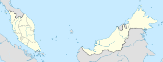
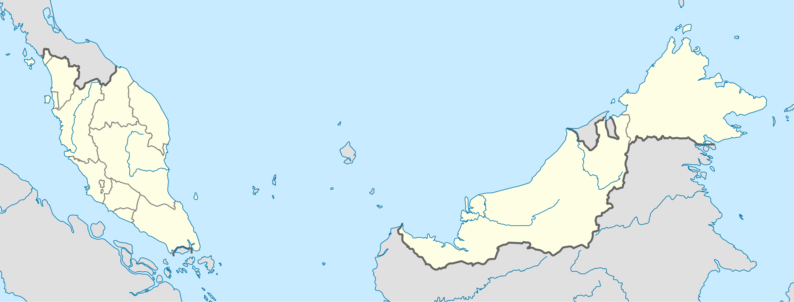
English: Location map of Malaysia.
Equirectangular projection. Strechted by 100.0%. Geographic limits of the map: * N: 8.0° N * S: 0.0° N * W: 99.0° E * E: 120.0° EMade with Natural Earth. Free vector and raster map data @ naturalearthdata.com. |
| កាលបរិច្ឆេទ | |
| ប្រភព | ការងារផ្ទាល់របស់អ្នកផ្ទុកឡើង |
| អ្នកនិពន្ធ | Uwe Dedering |
| ទំរង់ផ្សេងទៀត |
|
ការដាក់អាជ្ញាប័ណ្ណ
I, the copyright holder of this work, hereby publish it under the following licenses:
ឯកសារនេះជាប់អាជ្ញាបណ្ឌCreative Commons Attribution-Share Alike 3.0 Unported។
- អ្នកមានសិទ្ធិ៖
- ចែកចាយ – ថតចំលងនិងចែកចាយស្នាដៃនេះ
- កែច្នៃ – កែច្នៃយកទៅប្រើ
- ក្រោមលក្ខខណ្ឌដូចតទៅនេះ៖
- ភាពជាម្ចាស់កម្មសិទ្ធ – You must give appropriate credit, provide a link to the license, and indicate if changes were made. You may do so in any reasonable manner, but not in any way that suggests the licensor endorses you or your use.
- share alike – If you remix, transform, or build upon the material, you must distribute your contributions under the same or compatible license as the original.

|
រូបភាពនៃទំព័រនេះជាកម្មសិទ្ធិរបស់GNU Free Documentation License។ Version 1.2 ឬក៏ខ្ពស់ជាងនេះត្រូវបានឧបត្ថមគាំទ្រដោយ មូលនិធិសូហ្វវែរដោយឥតគិតថ្លៃ (Free Software Foundation) ដែលមិនមានផ្នែកណាមួយរបស់ប្រភពដើមរួមទាំងអក្សរនៅលើគំរបមុខនិងខ្នង ត្រូវបានផ្លាស់ប្តូរទេ។ ចំពោះផ្នែកដែលមិនអាចផ្លាស់ប្តូរបាន សូមមើលGNU Free Documentation License។ |
You may select the license of your choice.
ប្រវត្តិឯកសារ
ចុចលើម៉ោងនិងកាលបរិច្ឆេទដើម្បីមើលឯកសារដែលបានផ្ទុកឡើងនៅពេលនោះ។
| ម៉ោងនិងកាលបរិច្ឆេទ | កូនរូបភាព | វិមាត្រ | អ្នកប្រើប្រាស់ | យោបល់ | |
|---|---|---|---|---|---|
| បច្ចុប្បន្ន | ម៉ោង១៣:៤៥ ថ្ងៃច័ន្ទ ទី២២ ខែកុម្ភៈ ឆ្នាំ២០១០ | ១២០០ × ៤៥៧ (៤៩៩គីឡូបៃ) | Uwe Dedering | complete new version with right projection and colors | |
| ម៉ោង២៣:៣១ ថ្ងៃសៅរ៍ ទី១៨ ខែកក្កដា ឆ្នាំ២០០៩ | ១១៧០ × ៤០០ (៥៤០គីឡូបៃ) | Mdzafri | more detailed map. | ||
| ម៉ោង១៦:៣៨ ថ្ងៃច័ន្ទ ទី០៩ ខែកុម្ភៈ ឆ្នាំ២០០៩ | ១១៧១ × ៤០០ (៥៥៨គីឡូបៃ) | Doctor Dodge | resized to 400 x 1170 | ||
| ម៉ោង១៤:៤៣ ថ្ងៃច័ន្ទ ទី០៩ ខែកុម្ភៈ ឆ្នាំ២០០៩ | ៣០០០ × ១០២៥ (៥៥៨គីឡូបៃ) | Doctor Dodge | {{Information |Description={{en|1=Location map for Malaysia}} |Source=Own work by uploader |Author=Doctor Dodge |Date=9 febbraio 2009 |Permission= |other_versions= }} <!--{{ImageUpload|full}}--> Category:Location maps of Asia |
បម្រើបម្រាស់ឯកសារ
2 ទំព័រ ខាងក្រោមប្រើប្រាស់ឯកសារនេះ ៖
បម្រើបម្រាស់ឯកសារជាសាកល
វីគីដទៃទៀតដូចខាងក្រោមនេះប្រើប្រាស់ឯកសារនេះ៖
- ការប្រើប្រាស់នៅក្នុង ace.wikipedia.org
- ការប្រើប្រាស់នៅក្នុង af.wikipedia.org
- ការប្រើប្រាស់នៅក្នុង an.wikipedia.org
- ការប្រើប្រាស់នៅក្នុង ar.wikipedia.org
- ការប្រើប្រាស់នៅក្នុង ast.wikipedia.org
- Gran Premiu de Malasia de 2007
- Gran Premiu de Malasia de 2006
- Gran Premiu de Malasia de 2008
- Torres Petronas
- Menara Telekom
- Kuala Lumpur
- Aeropuertu Internacional de Penang - Malasia
- Putrajaya
- George Town
- Petaling Jaya
- Estadiu Nacional Bukit Jalil
- Península de Malaca
- Estrechu de Singapur
- Estrechu de Johor
- Torre de Kuala Lumpur
- Kuching
- Ipoh
- Malasia Peninsular
- Alor Setar
- Kota Kinabalu
- Johor Bahru
- Módulu:Mapa de llocalización/datos/Malasia
- Módulu:Mapa de llocalización/datos/Malasia/usu
- Aeropuertu Internacional de Kuala Lumpur
- Sepang
- Circuitu Internacional de Sepang
- Aeropuertu de Tawau
- Puertu de Johor
- Puertu de Kemaman
- Semporna
- Islla Tengah
- ការប្រើប្រាស់នៅក្នុង azb.wikipedia.org
- ការប្រើប្រាស់នៅក្នុង az.wikipedia.org
View more global usage of this file.