ឯកសារ:Relief Map of Kazakhstan.png

ទំហំរបស់ការមើលមុននេះ: ៨០០ × ៤៥៧ ភីកសែ។ ភាពម៉ត់ផ្សេងទៀត៖ ៣២០ × ១៨៣ ភីកសែ | ៦៤០ × ៣៦៦ ភីកសែ | ១២០០ × ៦៨៦ ភីកសែ។
រូបភាពដើម (១២០០ × ៦៨៦ ភីកសែល ទំហំឯកសារ៖ ១.២៤មេកាបៃ ប្រភេទ MIME៖ image/png)
ចំណារពន្យល់
| ការពិពណ៌នា |
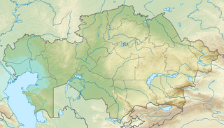
English: Location map of Kazakhstan
Equirectangular projection, N/S stretching 150 %. Geographic limits of the map:
|
| កាលបរិច្ឆេទ | |
| ប្រភព |
|
| អ្នកនិពន្ធ |
|
| ការអនុញ្ញាត (ប្រើឯកសារនេះឡើងវិញ) |
ឯកសារនេះជាប់អាជ្ញាបណ្ឌCreative Commons Attribution-Share Alike 3.0 Unported។
|
ប្រវត្តិឯកសារ
ចុចលើម៉ោងនិងកាលបរិច្ឆេទដើម្បីមើលឯកសារដែលបានផ្ទុកឡើងនៅពេលនោះ។
| ម៉ោងនិងកាលបរិច្ឆេទ | កូនរូបភាព | វិមាត្រ | អ្នកប្រើប្រាស់ | យោបល់ | |
|---|---|---|---|---|---|
| បច្ចុប្បន្ន | ម៉ោង១៧:១០ ថ្ងៃអាទិត្យ ទី០៩ ខែតុលា ឆ្នាំ២០២២ | | ១២០០ × ៦៨៦ (១.២៤មេកាបៃ) | NordNordWest | upd 2022 |
| ម៉ោង១៩:៤១ ថ្ងៃព្រហស្បតិ៍ ទី២៦ ខែសីហា ឆ្នាំ២០១០ |  | ១២០០ × ៦៨៦ (១.៣៩មេកាបៃ) | Виктор В | =={{int:filedesc}}== {{Information |Description={{en|Location map of Kazakhstan}} Equirectangular projection, N/S stretching 150 %. Geographic limits of the map: * N: 56° N * S: 40° N * W: 46° E * E: 88° E |Source=*[[:File:Kazakhsta |
បម្រើបម្រាស់ឯកសារ
ទំព័រ ខាងក្រោមប្រើប្រាស់ឯកសារនេះ ៖
បម្រើបម្រាស់ឯកសារជាសាកល
វីគីដទៃទៀតដូចខាងក្រោមនេះប្រើប្រាស់ឯកសារនេះ៖
- ការប្រើប្រាស់នៅក្នុង ar.wikipedia.org
- ការប្រើប្រាស់នៅក្នុង ast.wikipedia.org
- ការប្រើប្រាស់នៅក្នុង av.wikipedia.org
- ការប្រើប្រាស់នៅក្នុង azb.wikipedia.org
- ការប្រើប្រាស់នៅក្នុង az.wikipedia.org
- Balxaş
- Şablon:Yer xəritəsi Qazaxıstan
- Alagöl (Qazaxıstan)
- Mangistau yarımadası
- Aral gölü
- Vernı zəlzələsi (1887)
- Bozaşı yarımadası
- Spirkin Oseredok
- Janbay
- Durnev
- Tülen adaları
- Kulalı
- Manqışlaq körfəzi
- Böyük Peşnıye adaları
- Qazax körfəzi
- Kaydak körfəzi
- Myortvıy Kultuk körfəzi
- Qızılqum
- Üstyurd
- Mirzəçöl
- Aral Qaraqumu
- Çaqan gölü
- Bayanaul Milli Parkı
- İle-Alatau Milli Parkı
- Altın-Emel Milli Parkı
- Betpak-Dala
- Narın qumlar (səhra)
- Tauqum
- Jalqum
- Lyuqqum
- Barbıqum
- Böyük və Kiçik Porsuq
- Ayğırqum
- Sarıesik-Atırau
- Bestasqum
- Uzun-Aral
- Muyunqum
- Jamanqum
- Aralqum
- Barmaqqum
- Batpaysaqır
- Qaraqum (Almatı dairəsinin şimalında səhra)
- Qaraqum (Almatı dairəsinin cənubunda səhra)
- Muyunqum (Alma-ata dairsində səhra)
View more global usage of this file.