ឯកសារ:Taiwan Strait.png
ទំហំរបស់ការមើលមុននេះ: ៥១០ × ៥៩៩ ភីកសែ។ ភាពម៉ត់ផ្សេងទៀត៖ ២០៤ × ២៤០ ភីកសែ | ៤០៩ × ៤៨០ ភីកសែ | ៦៨១ × ៨០០ ភីកសែ។
រូបភាពដើម (៦៨១ × ៨០០ ភីកសែល ទំហំឯកសារ៖ ២០៧គីឡូបៃ ប្រភេទ MIME៖ image/png)
ចំណារពន្យល់
| ការពិពណ៌នា |
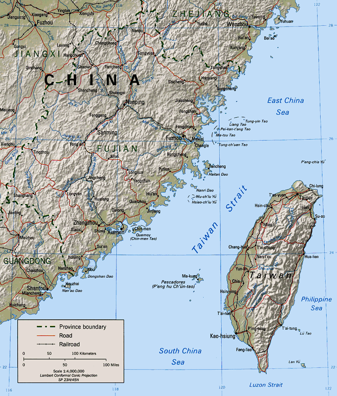
English: Map of the Taiwan Strait Bân-lâm-gú:Tâi-uân Hái-kiap. 臺灣海峽 中文(中国大陆):台湾海峡地图 中文(简体):台湾海峡地图 中文(臺灣):臺灣海峽地圖 中文(香港):臺灣海峽地圖 中文(繁體):臺灣海峽地圖 |
|||
| ប្រភព | Perry-Castañeda Library (Cleaned up version of en:Image:Taiwan straits.jpg, which is a work by the United States' government.) | |||
| អ្នកនិពន្ធ | "The following maps were produced by the U.S. Central Intelligence Agency, unless otherwise indicated." | |||
| ការអនុញ្ញាត (ប្រើឯកសារនេះឡើងវិញ) |
|
ការដាក់អាជ្ញាប័ណ្ណ
| This image is a work of a Central Intelligence Agency employee, taken or made as part of that person's official duties. As a Work of the United States Government, this image or media is in the public domain in the United States.
|

|
ប្រវត្តិឯកសារ
ចុចលើម៉ោងនិងកាលបរិច្ឆេទដើម្បីមើលឯកសារដែលបានផ្ទុកឡើងនៅពេលនោះ។
| ម៉ោងនិងកាលបរិច្ឆេទ | កូនរូបភាព | វិមាត្រ | អ្នកប្រើប្រាស់ | យោបល់ | |
|---|---|---|---|---|---|
| បច្ចុប្បន្ន | ម៉ោង០៣:៣១ ថ្ងៃសៅរ៍ ទី១៥ ខែមករា ឆ្នាំ២០០៥ | | ៦៨១ × ៨០០ (២០៧គីឡូបៃ) | MikeEdwards~commonswiki | Map of the Taiwan Strait -- pulled from Wikipedia for use in Wikinews{{GFDL}} |
បម្រើបម្រាស់ឯកសារ
ទំព័រ ខាងក្រោមប្រើប្រាស់ឯកសារនេះ ៖
បម្រើបម្រាស់ឯកសារជាសាកល
វីគីដទៃទៀតដូចខាងក្រោមនេះប្រើប្រាស់ឯកសារនេះ៖
- ការប្រើប្រាស់នៅក្នុង af.wikipedia.org
- ការប្រើប្រាស់នៅក្នុង ar.wikipedia.org
- ការប្រើប្រាស់នៅក្នុង ast.wikipedia.org
- ការប្រើប្រាស់នៅក្នុង azb.wikipedia.org
- ការប្រើប្រាស់នៅក្នុង az.wikipedia.org
- ការប្រើប្រាស់នៅក្នុង ba.wikipedia.org
- ការប្រើប្រាស់នៅក្នុង be-tarask.wikipedia.org
- ការប្រើប្រាស់នៅក្នុង be.wikipedia.org
- ការប្រើប្រាស់នៅក្នុង bg.wikipedia.org
- ការប្រើប្រាស់នៅក្នុង bn.wikipedia.org
- ការប្រើប្រាស់នៅក្នុង br.wikipedia.org
- ការប្រើប្រាស់នៅក្នុង ca.wikipedia.org
- ការប្រើប្រាស់នៅក្នុង cdo.wikipedia.org
- ការប្រើប្រាស់នៅក្នុង ceb.wikipedia.org
- ការប្រើប្រាស់នៅក្នុង cs.wikipedia.org
- ការប្រើប្រាស់នៅក្នុង da.wikipedia.org
- ការប្រើប្រាស់នៅក្នុង de.wikipedia.org
- ការប្រើប្រាស់នៅក្នុង en.wikipedia.org
- Wade–Giles
- 1995
- Second Sino-Japanese War
- Talk:Administrative divisions of Taiwan
- Sino-Soviet split
- Third Taiwan Strait Crisis
- Second Taiwan Strait Crisis
- Cross-Strait relations
- User:Mikepanhu/temp
- Pingtan Island
- Portal:Taiwan/Atlas
- Tancheng, Pingtan County
- Fifth Chen–Chiang summit
- User:Effer/China as an emerging superpower
- Portal:Taiwan/Geography
- Fujian–Taiwan relationship
- Wikipedia:In the news/Posted/November 2004
- Wikipedia:In the news/Posted/March 2005
- Wikipedia:WikiProject Military history/News/May 2024/Book reviews
- ការប្រើប្រាស់នៅក្នុង en.wikinews.org
- ការប្រើប្រាស់នៅក្នុង en.wiktionary.org
View more global usage of this file.