ឯកសារ:Wayne County Michigan Incorporated and Unincorporated areas Detroit highlighted.svg

Size of this PNG preview of this SVG file: ៨០០ × ៥៣៣ ភីកសែ. ភាពម៉ត់ផ្សេងទៀត៖ ៣២០ × ២១៣ ភីកសែ | ៦៤០ × ៤២៧ ភីកសែ | ១០២៤ × ៦៨៣ ភីកសែ | ១២៨០ × ៨៥៣ ភីកសែ | ២៥៦០ × ១៧០៧ ភីកសែ | ១២០០ × ៨០០ ភីកសែ។
រូបភាពដើម (ឯកសារប្រភេទSVG ១២០០ × ៨០០ ភីកសែល ទំហំឯកសារ៖ ១៣៦គីឡូបៃ)
| ការពិពណ៌នា |
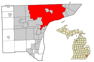
This map shows the incorporated and unincorporated areas in Wayne County, Michigan.
|
||||||||
| កាលបរិច្ឆេទ | |||||||||
| ប្រភព | My own work, based on public domain information. Based on similar map concepts by Ixnayonthetimmay | ||||||||
| អ្នកនិពន្ធ | Arkyan | ||||||||
| ការអនុញ្ញាត (ប្រើឯកសារនេះឡើងវិញ) |
I, the copyright holder of this work, hereby publish it under the following licenses:
ឯកសារនេះជាប់អាជ្ញាបណ្ឌCreative Commons Attribution-Share Alike 2.5 Generic, 2.0 Generic និង 1.0 Generic។
You may select the license of your choice. |

ប្រវត្តិឯកសារ
ចុចលើម៉ោងនិងកាលបរិច្ឆេទដើម្បីមើលឯកសារដែលបានផ្ទុកឡើងនៅពេលនោះ។
| ម៉ោងនិងកាលបរិច្ឆេទ | កូនរូបភាព | វិមាត្រ | អ្នកប្រើប្រាស់ | យោបល់ | |
|---|---|---|---|---|---|
| បច្ចុប្បន្ន | ម៉ោង១៩:៣០ ថ្ងៃច័ន្ទ ទី២៣ ខែមេសា ឆ្នាំ២០០៧ | | ១២០០ × ៨០០ (១៣៦គីឡូបៃ) | Shereth | {{Information |Description=This map shows the incorporated and unincorporated areas in Wayne County, Michigan, highlighting Detroit in red. I created it in Inksc |
បម្រើបម្រាស់ឯកសារ
2 ទំព័រ ខាងក្រោមប្រើប្រាស់ឯកសារនេះ ៖
បម្រើបម្រាស់ឯកសារជាសាកល
វីគីដទៃទៀតដូចខាងក្រោមនេះប្រើប្រាស់ឯកសារនេះ៖
- ការប្រើប្រាស់នៅក្នុង af.wikipedia.org
- ការប្រើប្រាស់នៅក្នុង ang.wikipedia.org
- ការប្រើប្រាស់នៅក្នុង anp.wikipedia.org
- ការប្រើប្រាស់នៅក្នុង ar.wikipedia.org
- ការប្រើប្រាស់នៅក្នុង arz.wikipedia.org
- ការប្រើប្រាស់នៅក្នុង ast.wikipedia.org
- ការប្រើប្រាស់នៅក្នុង as.wikipedia.org
- ការប្រើប្រាស់នៅក្នុង av.wikipedia.org
- ការប្រើប្រាស់នៅក្នុង awa.wikipedia.org
- ការប្រើប្រាស់នៅក្នុង azb.wikipedia.org
- ការប្រើប្រាស់នៅក្នុង az.wikipedia.org
- ការប្រើប្រាស់នៅក្នុង bh.wikipedia.org
- ការប្រើប្រាស់នៅក្នុង bjn.wikipedia.org
- ការប្រើប្រាស់នៅក្នុង bn.wikipedia.org
- ការប្រើប្រាស់នៅក្នុង bs.wikipedia.org
- ការប្រើប្រាស់នៅក្នុង ca.wikipedia.org
- ការប្រើប្រាស់នៅក្នុង cbk-zam.wikipedia.org
- ការប្រើប្រាស់នៅក្នុង ceb.wikipedia.org
- ការប្រើប្រាស់នៅក្នុង ckb.wikipedia.org
- ការប្រើប្រាស់នៅក្នុង dty.wikipedia.org
- ការប្រើប្រាស់នៅក្នុង dv.wikipedia.org
- ការប្រើប្រាស់នៅក្នុង el.wikipedia.org
- ការប្រើប្រាស់នៅក្នុង en.wikipedia.org
View more global usage of this file.