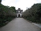
ខេត្តហ៊ឹងអៀន
| អត្ថបទនេះ ត្រូវការការដកស្រង់ ឬ ឯកសារយោងបន្ថែមសម្រាប់ការផ្ទៀងផ្ទាត់ (November 2015) |
ខេត្តហ៊ឹងអៀន គឺជាខេត្តមួយនៅតំបន់ដីសណ្ដទន្លេក្រហមនៃភាគខាងជើងប្រទេសវៀតណាម ។ វាគ្របដណ្តប់លើផ្ទៃដី 930.22 square kilometres (359.2 sq mi) រួមមានទីក្រុង១ ស្រុកជនបទ៨ និងទីប្រជុំជនកម្រិតស្រុក១ ដែលមានប្រជាជនជាង១ លាននាក់គិតត្រឹមឆ្នាំ២០១៩ ។ ខេត្តនេះជាកន្លែងតាំងលំនៅតាមច្រាំងទន្លេក្រហម ជាប់ព្រំប្រទល់នឹងខេត្តក្រុងចំនួន៥ ( ខេត្តបាកនិញ, ខេត្តហាយសឿង, រដ្ឋធានីហាណូយ, ខេត្តថាយប៊ិញ, ខេត្តហាណាម )។
| Hưng Yên province Tỉnh Hưng Yên | |
|---|---|
| ខេត្ត | |
| [[File:|250px|none|alt=|]] | |
| រហស្សនាម: Idyllic Prosperity | |
 | |
[[File: |250px|none|alt=|Location of Hưng Yên province]] |250px|none|alt=|Location of Hưng Yên province]] | |
| Country | |
| Region | Red River Delta |
| Capital | Hưng Yên |
| Subdivision | 1 city, 8 rural districts, one town |
| រដ្ឋាភិបាល | |
| • ប្រភេទ | Province |
| • Body | Hưng Yên Provincial People's Council |
| • Chairman of People's Council | Trần Quốc Toản |
| ផ្ទៃក្រឡា[១] | |
| • ខេត្ត | ៩៣០.២២ គម2 (៣៥៩.១៦ ម៉ាយ ការ) |
| ប្រជាជន (2021)[២] | |
| • ខេត្ត | ១,២៦៩,០៩០ |
| • សន្ទភាព | ០.០០១៤/km2 (០.០០៣៥/sq mi) |
| • Urban | ២០៩,៧២៦ |
| Ethnic groups[២] | |
| • Vietnamese[៣] | 99.1% |
| Area codes | 221 |
| ក្រមអ.ម.អ. ៣១៦៦ | VN-66 |
| ការចុះឈ្មោះយានយន្ត | 89 |
| Climate | Cwa |
| គេហទំព័រ | hungyen.gov.vn |
ឯកសារយោង
កែប្រែ- ↑ "Phê duyệt và công bố kết quả thống kê diện tích đất đai của cả nước năm 2018" (ជាVietnamese). Act No. 2908/QĐ-BTNMT of Error: the
dateoryearparameters are either empty or in an invalid format, please use a valid year foryear, and use DMY, MDY, MY, or Y date formats fordate. Ministry of Natural Resources and Environment (Vietnam). http://www.monre.gov.vn/VanBan/Lists/VanBanChiDao/Attachments/2299/QD%202908.rar. - the data in the report are in hectares, rounded to integers - ↑ ២,០ ២,១ General Statistics Office of Vietnam (2021). "Completed Results of the 2019 Viet Nam Population and Housing Census". Statistical Publishing House (Vietnam). ល.ស.ប.អ. 978-604-75-1532-5. https://www.gso.gov.vn/wp-content/uploads/2019/12/Ket-qua-toan-bo-Tong-dieu-tra-dan-so-va-nha-o-2019.pdf.
- ↑ Also called Kinh people


