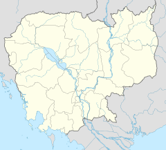
ស្រុករលាប្អៀរ
ស្រុករលាប្អៀរ ខេត្តកំពង់ឆ្នាំង
២៧ ខែវិច្ឆិកា ២០២៤
| Rolea B'ier ស្រុករលាប្អៀរ | |
|---|---|
| District (srok) | |
 | |
| កូអរដោនេ: 12°12′N 104°39′E / 12.200°N 104.650°E | |
| Country | |
| Province | Kampong Chhnang |
| Communes | 13 |
| Villages | 131 |
| ប្រជាជន (1998)[១] | |
| • សរុប | ៨១,១៣៤ |
| ល្វែងម៉ោង | +7 |
| Geocode | 0406 |
ស្រុករលាប្អៀរ (អង់គ្លេស: Rolea B'ier District) ជាដែនរដ្ឋបាលស្ថិតនៅ ខេត្តកំពង់ឆ្នាំង ដែលមានរដ្ឋបាល ១៣ឃុំ និង ១៣៥ភូមិ÷
| ស្រុករលាប្អៀរ | |||
|---|---|---|---|
| លេខកូដឃុំ | ឈ្មោះឃុំជាអក្សរខ្មែរ | ឈ្មោះឃុំជាអក្សរអង់គ្លេស | ចំនួនភូមិ |
| ០៤០៦០១ | ឃុំអណ្ដូងស្នាយ | Andoung Snay Commune | ៧ |
| ០៤០៦០២ | ឃុំបន្ទាយព្រាល | Banteay Preal Commune | ១០ |
| ០៤០៦០៣ | ឃុំជើងគ្រាវ | Cheung Kreav Commune | ១១ |
| ០៤០៦០៤ | ឃុំជ្រៃបាក់ | Chrey Bak Commune | ១៦ |
| ០៤០៦០៥ | ឃុំគោកបន្ទាយ | Kouk Banteay Commune | ៨ |
| ០៤០៦០៦ | ឃុំក្រាំងលាវ | Krang Leav Commune | ៨ |
| ០៤០៦០៧ | ឃុំពង្រ | Pongro Commune | ១២ |
| ០៤០៦០៨ | ឃុំប្រស្នឹប | Prasnoeb Commune | ៧ |
| ០៤០៦០៩ | ឃុំព្រៃមូល | Prey Mul Commune | ៧ |
| ០៤០៦១០ | ឃុំរលាប្អៀរ | Rolea B'ier Commune | ៦ |
| ០៤០៦១១ | ឃុំស្រែថ្មី | Srae Thmei Commune | ១២ |
| ០៤០៦១២ | ឃុំស្វាយជ្រុំ | Svay Chrum Commune | ២២ |
| ០៤០៦១៣ | ឃុំទឹកហូត | Tuek Hout Commune | ៩ |
| ចំនួនភូមិសរុប | ១៣៥ | ||
- យោងតាម ប្រកាសលេខ៤៩៣ ប្រ.ក របស់ក្រសួងមហាផ្ទៃ
ព្រំប្រទល់នៃស្រុករលាប្អៀរ
| ស្រុករលាប្អៀរ | ទិស | |||
|---|---|---|---|---|
| ខាងកើត (E) | ខាងលិច (W) | ខាងត្បូង (S) | ខាងជើង (N) | |
ឯកសារយោង
កែប្រែតំណភ្ជាប់ខាងក្រៅ
កែប្រែឯកសារពិគ្រោះ
កែប្រែ- គណកម្មការជាតិរៀបចំការបោះឆ្នោត Archived 2010-09-11 at the វេយប៊ែខ ម៉ាស៊ីន.
- ខេត្ត/ក្រុងនៅប្រទេសកម្ពុជា
- ក្រសួងទេសចរកម្ពុជា Archived 2008-04-15 at the វេយប៊ែខ ម៉ាស៊ីន.
អត្ថបទផ្សេងទៀត
កែប្រែ
Coordinates: 12°12′N 104°39′E / 12.200°N 104.650°E
- ↑ General Population Census of Cambodia, 1998: Village Gazetteer. National Institute of Statistics. February, 2000. pp. 80–83.
