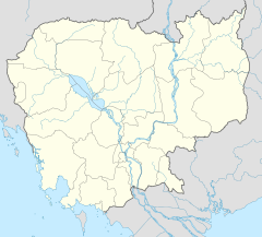
ស្រុកដំបែ
ឃុំឈូក គឺជាស្រុកមួយក្នុងចំណោមស្រុកទាំង នៃខេត្តកំពង់ចាម ហើយទីរួមស្រុកក៏ត្រូវបានគេហៅថា ដំបែ ផងដែរ។ ទីរួមស្រុកនេះ មានទីតាំងតាមបណ្ដោយផ្លូវជាតិលេខ៧៣ ប្រមាណ១១គីឡួម៉ែតពីផ្លូវជាតិលេខ៧។ ទីរួមស្រុកដំបែ ស្ថិតនៅចម្ងាយប្រម៉ាណ ៤៥គីឡូម៉ែត ភាគខាងលិចនៃក្រុងកំពង់ចាម ដែលជាទីរួមខេត្តកំពង់ចាម និង៤៧គីឡូម៉ែត ភាគខាងត្បូងក្រុងក្រចេះនៃខេត្តក្រចេះ។[២]
| ស្រុកដំបែ | |
|---|---|
| ស្រុក | |
| កូអរដោនេ: 11°54′40″N 105°51′15″E / 11.91111°N 105.85417°E | |
| ប្រទេស | |
| ខេត្ត | កំពង់ចាម |
| ឃុំ | 7 |
| ភូមិ | 63 |
| ប្រជាជន (1998)[១] | |
| • សរុប | ៥១,៦៥០ |
| ល្វែងម៉ោង | +7 |
| Geocode | 0304 |
ស្រុកដំបែ គឺជា
Dambae district is home to the Haung resort and waterfall, a popular picnic and holiday spot. The falls are located in Srae Veng Village, Teuk Chrov Commune near the border with ស្រុកមេមត់ and about 90 kilometres from the provincial capital. Haung is set in beautiful mountain scenery including 1,800 hectares of natural forest. The waterfall is the most popular spot and over time, the falls have worn out a 1,425 square metre stone crater below the cascade.[៣]
ទីតាំង
កែប្រែស្រុកដំបែមានទីតាំងស្ថិតនៅភាគខាងកើតនៃខេត្តកំពង់ចាម ហើយមានព្រំប្រទល់ភាគខាងជើងជាប់ ស្រុកព្រែកប្រសព្វនៃខេត្តក្រចេះ ភាគខាងកើតជាប់ស្រុកមេមត់ ភាគខាងត្បួងជាប់ស្រុកពញាក្រែក និងភាគខាងលិចជាប់ជាមួយស្រុកត្បូងឃ្មុំ និងស្រុកក្រូចឆ្មារ នៃខេត្តកំពង់ចាម។[៤]
រដ្ឋបាល
កែប្រែស្រុកដំបែ (អង់គ្លេស: $ District) ជាដែនរដ្ឋបាលស្ថិតនៅ ខេត្តត្បូងឃ្មុំ ដែលមានរដ្ឋបាល ឃុំ និង ភូមិ÷
| ស្រុកដំបែ | |||
|---|---|---|---|
| លេខកូដឃុំ | ឈ្មោះឃុំជាអក្សរខ្មែរ | ឈ្មោះឃុំជាអក្សរអង់គ្លេស | ចំនួនភូមិ |
| ២៥០១០ | ឃុំចុងជាច | Chong Cheach Commune | |
| ២៥០១០ | ឃុំតំបែរ | Dambae Commune | |
| ២៥០១០ | ឃុំគោកស្រុក | Kouk Srok Commune | |
| ២៥០១០ | ឃុំនាងទើត | Neang Teut Commune | |
| ២៥០១០ | ឃុំសេដា | Seda Commune | |
| ២៥០១០ | ឃុំត្រពាំងព្រីង | Trapeang Pring Commune | |
| ២៥០១០ | ឃុំទឹកជ្រៅ | Tuek Chrov Commune | |
| ចំនួនភូមិសរុប | |||
ប្រជាសាស្ដ្រ
កែប្រែស្រុកដំបែ ត្រូវបានចែកចេញជា ៧ឃុំ និង៦៣ភូមិ។ [៥]
យោងទៅតាមជំរឿនឆ្នាំ១៩៩៨ ស្រុកនេះមានចំនួនប្រជាជនសរុបប្រមាណ ៥១៦៥០នាក់ មកពី ៩៧៣៨គ្រួសារ នៅឆ្នាំ១៩៩៨។ ជាមួយចំនួនប្រជាជនច្រើនជាង៥០០០០នាក់ ស្រុកដំបែគឺជាស្រុកមួយក្នុងចំណោមស្រុកដែលមានប្រជាជនរស់នៅតិចជាងគេនៅក្នុងខេត្តកំពង់ចាម ហើយក៏មានដង់ស៊ីដេប្រជាជនទាបជាងគេផងដែរ។ Only tiny Kampong Cham District which surrounds the provincial capital, has a smaller population. The average household size in Dambae is 5.2 persons per household, slightly higher than the rural average for Cambodia (5.1). The sex ratio in the district is 95.5%, with more females than males.[៦]
អប់រំ
កែប្រែបឋមសិក្សា
កែប្រែអនុវិទ្យាល័យ
កែប្រែមណ្ឌលសុភាព
កែប្រែមន្ត្រី
កែប្រែមន្ត្រីស្រុក
កែប្រែមន្ត្រីឃុំ
កែប្រែមន្ត្រីប៉ុស្ដិ៍
កែប្រែសាសនា
កែប្រែព្រះពុទ្ធសាសនា
កែប្រែវត្ត
កែប្រែផ្សារ
កែប្រែតំបន់ទេសចរណ៍
កែប្រែតំណភ្ជាប់ខាងក្រៅ
កែប្រែ- វិបសាយគ្រប់គ្រងភូមិបាល Archived 2009-02-10 at the វេយប៊ែខ ម៉ាស៊ីន.
ឯកសារពិគ្រោះ
កែប្រែ- គណកម្មការជាតិរៀបចំការបោះឆ្នោត Archived 2010-09-11 at the វេយប៊ែខ ម៉ាស៊ីន.
- ↑ General Population Census of Cambodia, 1998: Village Gazetteer. National Institute of Statistics. February, 2000. pp. 38–39.
- ↑ (ជាEnglish) Total Road Atlas of Cambodia 2006 (3rd edition រ.រ.). Total Cambodge. 2006. pp. 44.
- ↑ "Horng Resort" (in English). Kampong Cham Chamber of Commerce. Retrieved 2009-01-29.
{{cite web}}: CS1 maint: unrecognized language (link)[តំណភ្ជាប់ខូច] - ↑ "Kampong Cham Provincial Resources" (in English). Ministry of Commerce. Archived from the original on 2009-01-05. Retrieved 2009-01-25.
{{cite web}}: CS1 maint: unrecognized language (link) - ↑ "Kampong Cham Administration" (in English). Royal Government of Cambodia. Archived from the original on 2009-02-10. Retrieved 2009-01-29.
{{cite web}}: CS1 maint: unrecognized language (link) - ↑ General Population Census of Cambodia, 1998: Village Gazetteer. National Institute of Statistics. February, 2000. pp. 32–73.
